MIA-M10 series
u-blox M10 standard precision GNSS SiP modules
Insights
|
10 Jun 2022
GPS protection level gives tracking devices previously unavailable insight into the quality of their location estimates, offering new ways to improve the quality of service.
The accuracy of satellite-based positioning is notoriously sensitive to environmental factors. As the positioning receiver’s sky view gets increasingly restricted, it is forced to determine its position based on an ever-smaller subset of orbiting satellites, causing the achievable accuracy to deteriorate. Once less than three satellites are within the receiver’s line of sight, or if the sky view is fully obstructed inside a tunnel, beneath an underpass, or from within a very dense forest, the position calculation fails altogether.
Another common culprit behind poor positioning accuracy is multipath effects, caused, for example, when global navigation satellite system (GNSS) signals bounce off buildings before they reach the GNSS receiver. In particular in metropolitan areas that are densely packed with skyscrapers, these multipath effects can lead to errors in the tens of meters, causing automotive navigation solutions to locate themselves on the wrong lane or even the wrong road.
In each of these cases, GNSS receivers themselves have no insight into the magnitude of their actual positioning error. How could they, with no knowledge of their true position to which compare their output? Many receivers output a measure referred to as the accuracy estimate, determined using quality indicators drawn from the GNSS signals. But trials comparing the output of commercial GNSS receivers with much more expensive “truth” setups routinely reveal the actual error exceeding the accuracy estimate.
This lack of insight is more than just a nuisance. It can lead to false alarms, when, for example, body-worn trackers erroneously report pets, children, or vulnerable family members veering too far from home or beyond a virtual geofence. It can reduce efficiencies, by poorly locating assets such as shared bikes or e-scooters and forcing maintenance personnel to spend more time looking for them. And it can strain customer relationships, when customers are falsely billed for services they did not use or roads they didn’t drive on, as, for example, could be the case in pay-as-you-go road tolling.
GPS protection level takes a more advanced approach to dealing with positioning errors than the accuracy estimate. Rather than attempting to estimate the accuracy itself, it provides an upper bound on the likely position error, and that with 95% confidence in typical driving scenarios. In other words, statistically, the actual position error will only exceed the protection level around three minutes per hour. Most of the time, the tracking application or its users can use the protection level as a reliable quantity indicator – the closest thing to a certainty that they have at hand.
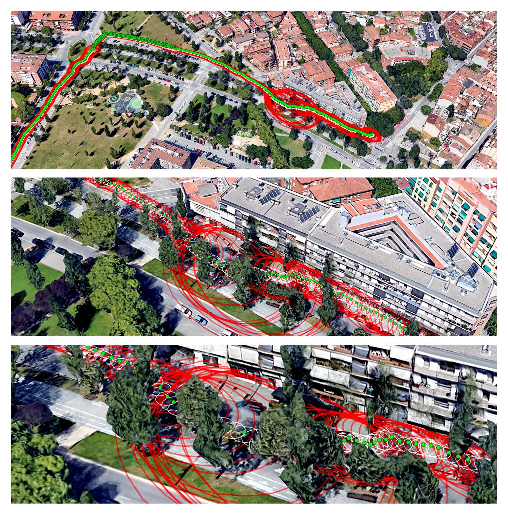
Data gathered during a pedestrian field trial in Sant Cugat, Spain, shows how the protection level output (in red) differs from the accuracy estimate (in white). In the image above, the reported position (in green) veers away from the tall apartment building, even as our tester’s true position (not depicted, because unavailable to the device) traces a straight line along the building’s façade.
The red protection level can be seen increasing abruptly as the apartment building and the surrounding trees partially obstruct its sky view. Meanwhile, the white accuracy estimate remains roughly the same size.
The setup for this field trial was not perfect, but reflects real-world deployments in several ways. We used a u-blox M10 evaluation kit with the type of antenna often used in people-tracking devices. The antenna was located in a backpack worn by the tester.
One thing is immediately obvious from the field trial data: In the case of unassisted, single-band GNSS positioning, the protection level output exceeds the actual position error – by quite a lot. In the most forgiving positioning environments, with a wide-open sky view, the protection level is about 2 meters. Its size dramatically increases as our tester walks along the tall building and under trees.
This begs the question: How can tracking and positioning applications gain maximum value from the availability of this new protection level metric? One way is by using it to raise a flag whenever the GNSS receiver detects that it has entered an unreliable positioning environment and then wait for the protection level to recover before reporting a new position to the cloud-based tracking platform.
A case that nicely illustrates its value is fleet management. Thanks to GPS technology, fleet managers can keep an eye on all their vehicles as they roam cities, delivering goods, transporting passengers, or performing other services. Because urban centers are among the most challenging positioning environments, inaccurate location data can trigger all kinds of alarms, informing headquarters that vehicles have veered off their intended trajectory or entered areas they were meant to avoid.
The protection level offers a new approach to addressing this challenge. As outlined earlier, a fleet tracking solution could, for example, be instructed not to issue alerts when the protection level is high, indicative of a challenging positioning environment. Once the surroundings become more favorable and the protection level decreases again, it could resume normal activity. Sure, some alerts would arrive with a delay. But depending on the specifics of the use case, that slight delay might be more than made up for by fewer false alarms.
Several use cases stand to benefit from the improved quality of service achieved by drawing on the protection level as a qualitative indicator of the validity of positioning data:
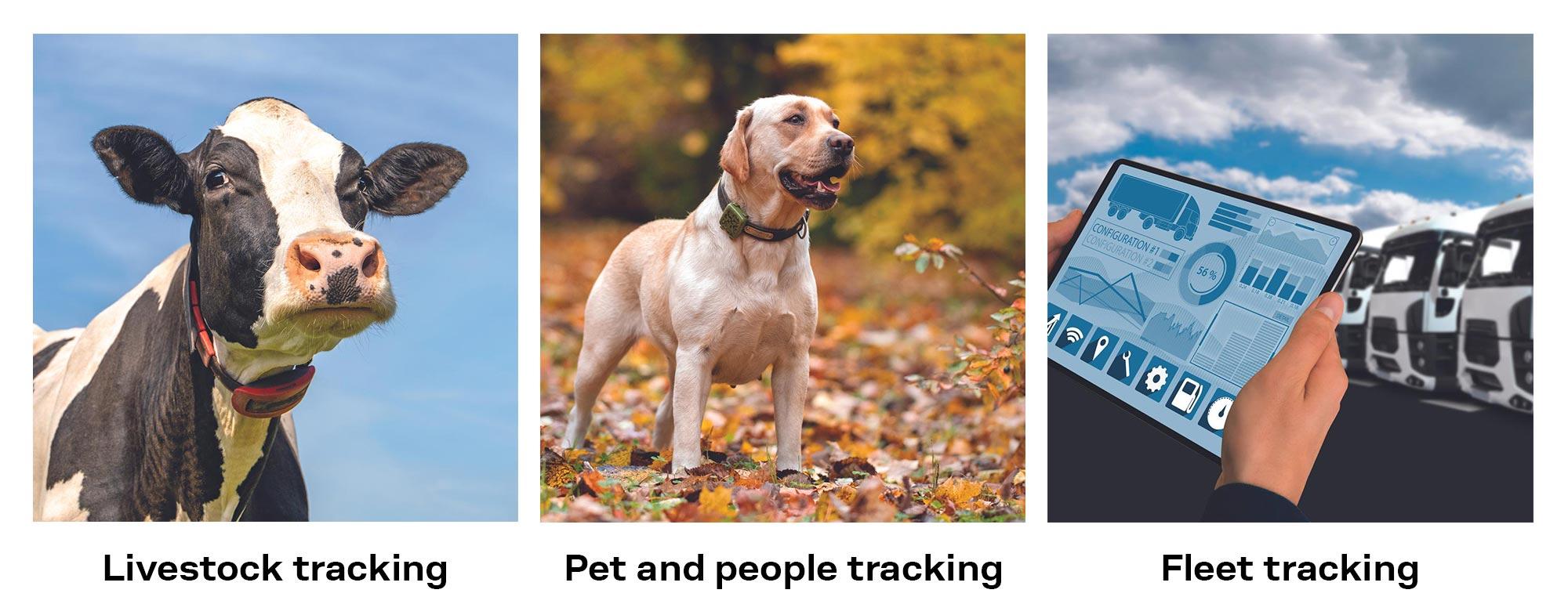
Livestock trackers could, for example, let cows graze on fenceless pastures controlling their movements with sounds or weak electrical shocks as they reach and overstep the border of their virtual enclosure. By gauging the quality of the position data using the protection level metric, farmers could avoid falsely administering shocks when GNSS errors, not the cows, are at fault. In addition to protecting the livestock, these improvements also allow the battery-powered trackers to save power.
Wearable people trackers are becoming increasingly commonplace as caregivers seek to keep an eye on their children, vulnerable elderly family members, and even their pets. Again, the protection level offers a potentially valuable metric to assess the reliability of the position data that can be used to reduce the number of false alarms triggered when the people being tracked are falsely reported to cross a geofence due to inaccurate positioning.
In use cases that switch off the GNSS receiver between updates to save power, the protection level also helps optimize the GNSS receiver’s on-time to achieve the best trade-off between power consumption and position accuracy.
Telematics data is already being used for fleet management, driver monitoring, and usage-based billing. Each of these use cases would benefit from being able to flag unreliable location data caused by the surrounding environment, e.g. when driving under bridges or beneath other covered areas. GPS protection level offers a unique estimate of the quality of the reported position in real-time and appropriately avoid reporting larger position outliers to improve the quality of service.
GPS protection level is available on u-blox F9 high precision and u-blox M10 standard precision chips and modules. If you’d like to learn more about how GPS protection level can add value to your IoT application, reach out to your nearest sales representative, fill out a project information form, or head over to the GPS protection level technology page on our website.
Bernd Heidtmann
Product Manager, Product Strategy for Standard Precision GNSS, u-blox
Lluis Cases
Senior Field Application Engineer, u-blox